 |
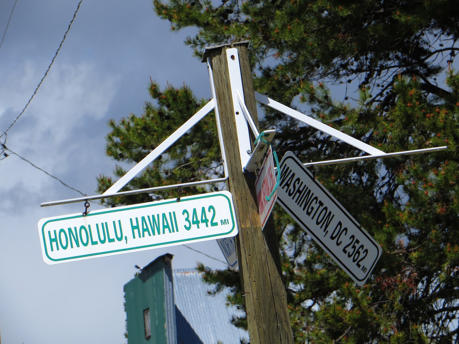
| the open road |
In a continuing effort to explore my home state of Oregon I determined to head for adventures in the northeast corner of the state. As Ralph Friedman, author of
Oregon for the Curious had done, I avoided the sterile interstate highway system and traveled the byways in search of people and places often overlooked by the traveller intent on just arriving somewhere. Deciding to take the minimalist approach, I camped in my car, saving space, time and effort. State, county and RV park campgrounds offered safe and inexpensive places to haul in for the night. Meals were simple, based on hot water added to elemental ingredients or meal-in-a-can on the sterno heat burner. After three days the sense of relaxation set in and makeup and hair-do were abandoned. No one I met even remotely reacted to this lack of artificial sophistication. I was finally on vacation time!
 |
| wind farm |
Driving through the familiar Columbia River Gorge Scenic area I anticipated what lay beyond. Douglas fir gave way to White pine as I passed "the line" at Hood River and watched the dark green forests fade to spring green grasses coating the Washington hills. Scrubbed of their basalt crags the hills take on a smooth, fresh buzz cut appearance. The temperature began to rise as the skies turned a milky blue. Missing my initial exit at Biggs Junction I followed a lesser highway through deep, dry canyons and over soft hills lush with wheat. Miles and miles of green hills lay ahead of me. Soon I began to see slender white windmills located on what are now called wind farms. They are "planted" all over the hills, whirling slowly above acres of green wheat. Thousands of these silent power generators are scattered on the tops of undulating hills.
 |
| Cottonwood S.P. on John Day River |
Turning down into Fulton Canyon the topography began to close in upon the highway and the distantly viewed smooth verdant hills revealed sharp, angular rocky edges when observed right next to my car window. Bits of rock continuously fall away from the steep hillsides in a campaign to reduce them to piles of rubble. Over time, that is part of the formation process of this area. Wild grasses, growing quickly on spring rains, bent to the steady winds giving the appearance of rolling waves of grain. A newly completed State Campground at Cottonwood Canyon on the John Day River was already being used by camper-equipped fishermen. There are no trees for shade here but plenty of tall grassy areas and a boat launch. Showers and flush toilets make this an upgraded camping spot.
 |
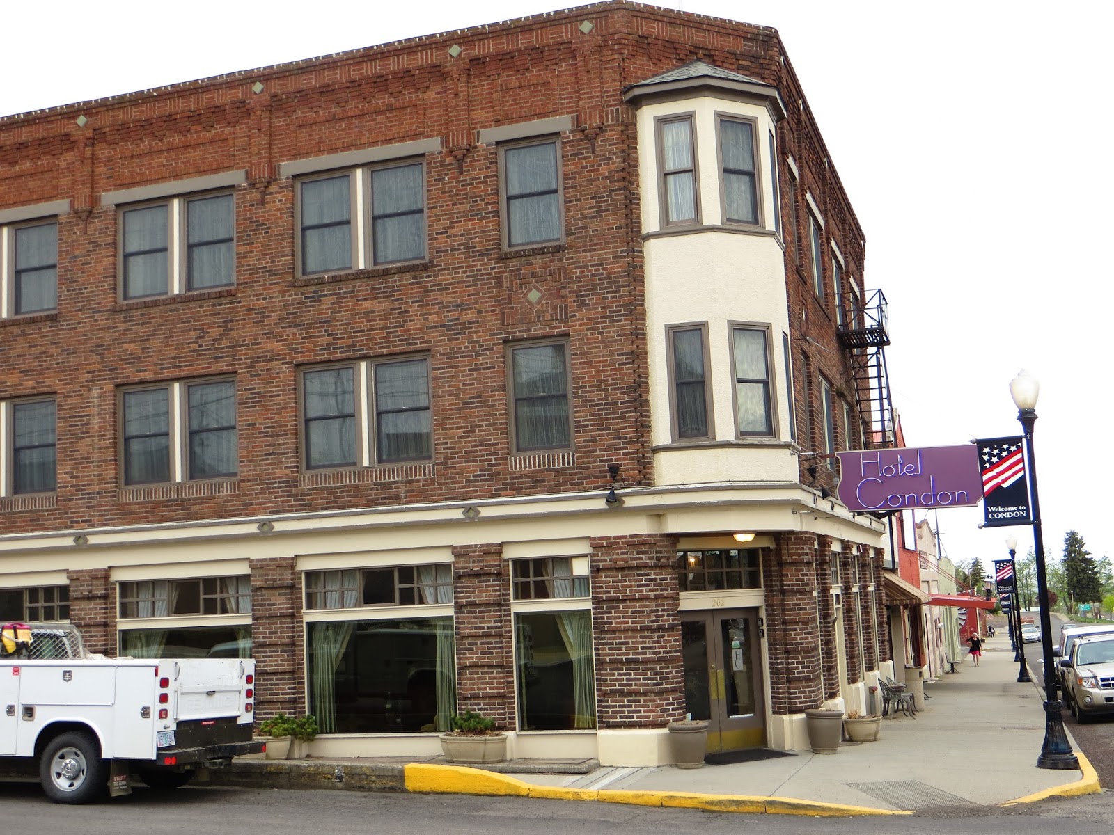
| Condon Hotel |
Rising out of the canyon onto the high desert plain, passing abandoned farms and houses, bunk houses, corrals and barns, this area becomes home to big agribusiness and cattle ranching. Little towns like Wasco, Condon and Fossil scramble for an existence in the hollows of the topography, waiting patiently for the tourist season and the money it will bring. A brief stop at the refurbished Condon Hotel was a step back in time for this area. At a local bank in Fossil, I found the people and their surroundings more modern than the decaying, aged buildings of the town. Friendly service with a smile and kids on their way home from school completed the scene of a typical rural township.
 |
| Shelton Wayside |
Storm clouds began to unload their watery weight on the area as I made my way to the Shelton Wayside, an offering of the Wheeler County Parks Department. For $10 a night I had a large grassy camping area to share with just a few early weekenders. Piped water and vault toilets were the major amenities but the extras of woodpecker pops, grouse and turkey calls and the reported sighting of a young bear and a group of deer solidified this charming nature spot. I chatted up a truck of friendly county and Forest Service workers collecting the day's fees and got the local news report. Although alone I am surrounded by God's creative genius and the rain-washed fresh air of this lovely scene. Pouring rain throughout the night was like sleeping under timpani drums in full orchestral use but by morning the cool, quiet dawn signaled a dry day for exploring fossil beds.
 |
| Mitchell abandoned boarding house |
Skipping the Clarno Unit of the
John Day Fossil Beds National Monument due to time, I headed south on Highway 207 through Mitchell, looking for a gas station. All the literature about this area strongly warns to keep your tank full as there is a dearth of available stations with miles of road in between them. With a short shopping list I entered the local market to see the owner slowly piecing a puzzle together. It was a picture of a tropical scene so I asked if she was dreaming of a vacation. She laughed softly, and reiterated the dreaming part. Walking the isles of the store it was obvious there was not much traffic here except for hurried tourists seeking more sunscreen or a snack. Inquiring what people do in this locality for a living she replied that they work for the school district or the county, own a business or work for one of the big cattle ranches. My small purchases seemed a sad but welcome break for her in an otherwise tedious day. The single gas station was attended by an aging biker fellow, friendly as could be and wanting to chat as long as my tank was filling. He, too, seemed contentedly resigned to the small town life.
 |
| Painted Hills |
It is a short distance west of Mitchell on Highway 26 to arrive at the Painted Hills Unit. This amazing and colorful display of eons of sedimentation, lava flows and erosion is like walking into a kaleidoscope world. Bands of color run across the multitude of softly rounded hills, shifting in hues as the sun courses across the sky. Without flora other than sticky juniper and sagebrush, this is a hot and inhospitable microclimate. Rocks and pebbled soil reflect the desert sun which bakes everything to a crisp. But the history locked in stone is the interesting draw after the initial multicolored vistas endlessly repeat. There is a small education station at this unit as well as signage along the way to explain the process of mineral and ash deposits and fossilization and the discovery of over 100 types of plants and animals sealed as impressions of a once-alive life in rock. While fossil hunting is prohibited here, there are samples of discoveries to view.
 |
| Sheep Rock Unit of fossil beds |
30 miles east of Mitchell is the Sheep Rock Unit and the Thomas Condon Paleontology Center. This cool, refreshing facility in the midst of the hot, dusty desert showcases some of the fossils discovered in the area. It has a windowed lab where fossil extraction can be viewed in process. Displays and videos as well as informed staff make this a definite stop before taking one of the many short hikes through the nearby hills. Always carry much more water than you think you will need when you take off for the hills as well as the
ten essentials.
Because camping is not allowed in the National Monument area, I reluctantly left this fascinating part of Oregon in search of a night's lodging. The notion was beginning to dawn on me that this trip would be too brief to take in all the sights and history that saturate this section of the state. Stopping in John Day for a few supplies I chatted up a local store clerk as to what she liked about living there. She echoed sentiments I was starting to hear everywhere I stopped in that she liked the small town togetherness and strong family ties. Everyone is a part of the town team and supports all local events. I briefly checked out Clyde Holliday S.P. and Bates S.P. but decided to push on to Baker City. The weather was looking doubtful and another night of timpani "music" was not high on my agenda.
 |
| Blue Mountains |
As it turned out, the Blue Mountains deliver spontaneous storms to that area and the sky quickly darkened along Highway 7, portending rough weather. Sure enough, the sky opened up with a flash and a kaboom and the roadway turned into a river as I drove at 55 mph. I began to hydroplane until I could slow down, the visibility diminishing to zero. I kept looking in my rear view mirror for approaching trucks unaware of my existence in front of them but didn't encounter any. Pelting rain followed me through the passes and into Baker City where it was now past sunset. Not having planned for a city overnight stop I inquired at a local store about camping sites and was pointed to a local RV park. Finding it closed for the evening I parked quietly in a tent spot, tucked in for a noisy night and awoke at 5 a.m. to find the park still closed. Leaving an adequate fee I made for the road and thought I was in La Grande for a moment, temporarily disoriented map-wise. Clearing up that little issue I drove into town to find a dry spot for coffee and breakfast. A Starbuck's gift card courtesy of a daughter saved the day and gave me time to plot my day's trip.
 |
| Covered wagon replicas |
Gazing around in the bright morning sunlight I was impressed to see the snow-fringed mountain ranges encircling Baker City. The Blues on the west and the Wallowas on the east shelter the valley in between. That's not to say they don't get heat and snow in turn, but the visual display of giant protection was quite amazing. I tried to imagine the thoughts of pioneers coming along the Snake River and finding this oasis. The
Oregon Trail Interpretive Center just east of the city offers a splendid display of the high cost pioneers paid in order to reach and establish the western sections of the Oregon Territory. Their wagon trains were about the size of my car and their supplies more basic than my minimalist efforts. As I hiked below the Center to the few remaining visible ruts of the Oregon trail I saw up close just how difficult the journey was, bumping along over sage brush and boulders, thirsty and bone-tired, seeing that green valley ahead of them and wanting to race for the cool river and lush grassland. What heroes they were!
 |
| Wallowa Lake from tram |
Heading for Wallowa Lake I took the interstate to make time, skipped La Grande for the time being and turned onto Highway 82 for another tour of small towns, this time at the feet of the Wallowa Mountain range. Alicel, Imbler, Elgin, Minam, Wallow, Lostine, Enterprise and Joseph offer a look into the early days of this area's settlement. Aging grey barns and plain little houses line Main Street in each town interspersed with Victorian gingerbread-trimmed, two-storied houses of a certain age. Remnants of ancient trees are now situated too close to the road, evidence of an earlier time when the road was not paved and more narrow. Circling the mountain range I was able to view it from both sides, one at a distance and the other very close indeed as I approached the lake just outside of Joseph. There, nestled in the arms of nearly 10,000 foot peaks, lies the glacially scooped out lake of Wallowa. Long and narrow, reflecting the sky of the moment and the snow-capped summits of the mountains is a glassy bowl of water 283 feet deep but once covered by 1500 feet of ice!
 |
| Snowpack on Mt. Howard |
This being Memorial Day weekend the State Park at the lake was filled to capacity. I, without a reservation, smiled endearingly at the Ranger as I inquired about a possible tent site. Once he learned I wasn't staying the entire weekend a site became available and I gratefully settled in for the afternoon and evening. My agenda here was to ride the tram to the top of Mt. Howard above the lake for a brochure-like vista. However, the Ranger mentioned a doubtfulness as to the tram's operational readiness. The next day was to be it's opening run but there were delays occurring. Checking at the tram ticket office I was assured it would be running but that there was not much chance to hike at the 8300 foot summit due to the remaining snowpack. To complicate the situation, rain began to fall in buckets again and my tour of the park and lakeside dock were from beneath an umbrella. Another timpani night was in my future. During a break in the downpour I sat reading at my picnic table when I felt a presence beside me. Glancing slowly to my left I met a deer face to face, it seeming to casually say "hey! how's it going?" as it sauntered slowly through a series of campsites on it way to the woods. Yup! Camping in
their territory. As darkness and rain fell simultaneously a family next door was setting up camp with their six children under the age of ten. The kids were so excited that they didn't understand the urgency of mom and dad trying to set up a tent so bounced on everything that piled out of the car. They shrieked at tag, tossed material into the fire, bounded beyond the borders of their site as the loud commands of their mother to return and settle down rose in decibels. Yes. They were boys. It was mayhem and noise until 1:30 a.m.
 |
| Golden mantle ground squirrel |
Rising early, wanting to be near the front of the line to gain as much time up top as possible, I bought my $25 tram ticket and learned I could ride it as often as I wanted that day. The travel could be fun even if I couldn't hike anywhere! Sure enough, the clearing at the park gave way to fog and snow as we neared the top of the line. Swaying gently at every support pole juncture, the tiny bucket pulled us higher and higher up a slope too steep to hike. Chilly air and dirty snow met us as the bucket opened in the landing hut. Checking out the trail map I decided to take a stab at hiking the rim but soon realized that there was no trail, only a snowcat scraping and lots of slush and mud. Braving the conditions for a mile or so I finally turned around to return to the hut.
Golden mantle ground squirrels scampered in and out of the rocks and begged for tidbits of food below the snack area, capturing the attention of everyone as views of the lake were cloud-obscured. There were no brochure vistas on this day but it was a worthwhile ride to find that out. Returning to my campsite I concluded that another boisterous evening with the boys would not amuse me. Car camping made it easy to drive away without a fuss and retreat around the Wallowas once again. Near the end of the lake is a monument to Chief Joseph the elder, father of the also famous Chief Joseph or Young Joseph. Their Nez Perce relocation
story is a sad point in American history. This location is the burial site of the elder while the younger Joseph is buried in Colville, WA, on the reservation there.
 |
| Catherine Creek S.P. area |
Sidestepping La Grande one more time I took the 203 byway that parallels the interstate but meanders through Union and Medical Springs on its way to Baker City. It's a quiet country journey familiar to
Cycle Oregon participants through the years. Pulling in to Catherine Creek State Park about half way along the route, I knew I had found a resting place. Wedged between the road and the creek, this campground is a small, quiet fisherman's destination complete with flush toilets and a pay phone but no showers, electricity or cell coverage. The camp hosts were a delightful retired couple housed in a motor home and planning their hosting opportunities around the area as well as the purchase of their new motor home with more pullouts once their property in Tygh Valley sold. They were recruiting more camp hosts with their state brochures and lively tales of previous camps. There's often a warm friendship in these wandering volunteers which is one reason I chat them up.
Starved for substantial protein I had purchased roasted chicken at a Walmart store and it caused no little amount of salivation during the drive to camp. Once settled, which means I parked the car on level ground and got out, I tucked into that bird with ravenous fury. No one paid much attention to my finger-lickin' happy time and a little hike around the area settled dinner. Leftovers for breakfast! Tuning the radio station to 1450 AM I picked up some old time radio drama programs such as "
Night Editor". What entertaining word pictures! As the sun slipped behind the western rim of the wooded hills the pleasant sound of rushing creek waters and bedtime bird calls lulled me to sleep for 12 restful hours!
 |
| clean boy in a dog bucket |
Waking to a glorious, rain-free morning I took stock of my neighbors, a family speaking French to their three little well-behaved boys and English to their black and white Great Dane pup Delilah. Warming to each other as the day progressed, I learned they are the owners/operators of Atlas Immersion Academy and French daycare in Portland. Living up to their roles in business they plied their young boys with observations and engagements with nature, taking a trip to a nearby wildlife refuge. I found a black and orange caterpillar lumbering about the camp and brought it to them for examination which they did with wonderment and total fascination. It added to the adventures of their day with a snake, mouse and various waterfowl. Mom's birthday was on the docket and dad baked a cake in a cast iron pan over the fire, frosted it and invited me to share in the treat. The boys picked bouquets of wildflowers for their mom and Delilah bounced about at the end of her tether. Once the festivities were concluded, baby Remy who was all smeared in chocolate frosting found his bath in the dog's five gallon water bucket after fire-warmed water was added to it. My $1 bar of Ivory soap from the Mitchell store rounded out the wash up. This family really had it altogether!
 |
| Catherine Creek trail |
Morning at Catherine Creek brought more holiday travelers and children to add that joyful touch of laughter. The steady breeze over the creek carried a warm scent of pine and butterflies of various colorings flitted from flower to flower. A loop hike of about five miles took me into the woods above camp in the canyon to various viewpoints above of the lava layers similar to those near The Dalles. Volcanic activity over the millennia built up levels that were then carved away by water erosion. The water levels have diminished to the current river formations. Water-loving cottonwood trees lining the banks were releasing their white puffs which were carried here and there by the currents. Time for me to fly too.
 |
| Baker City main drag |
Finishing the byway I landed in Baker City and was overwhelmed by the history that I discovered there. The city
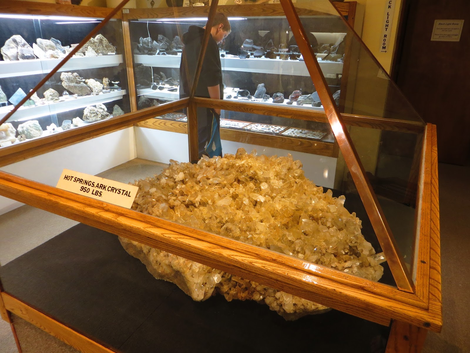
museum opened early and was a free day because of the holiday as well as for the military display in the main lobby. Meeting Lea Hoover, the museum manager, was a double treat. She not only possesses broad knowledge of the area's heritage and is passionate about it but she is a young woman dedicated to preserving it in a business that is often handled by aging patrons who will carry much of their experience and knowledge to their graves. Lea oriented me to the museum's holdings, including an extensive
mineral exhibit and topical survey exhibits of mining, farming, cattle ranching, Chinese labor and timber in the swimming pool cavern of this former natatorium. Gold mining was a major industry in the heyday of the gold rush era and some mines continue to function even today.
Leo Adler, a major patron in the city brought magazine publishing to Baker City and then proceeded to sponsor many of the public and charitable works there, enriching the lives of the residents. His former home is a museum in itself.
 |
| Absolutely! |
After strolling the main avenue in downtown I stopped for lunch at the AAA recommended
Lone Pine Cafe, so named for the single,
lone pine that pioneers and other travelers looked for as they entered this valley. Creative twists on the regular fare of small cafes made this stop a taste treat. Rather than eat my way through town on this trip, I will return and sample more of this town's eateries. Once again, the answer to the question "what do you like about living here?" was all about small town friendliness, mutual support and family. Many, like Lea, are drawn back by family ties or marriage connections. Baker City is a town that makes you feel right at home.
The next leg of my road trip took me east on Highway 86, destination Hell's Canyon. Pausing once again to visit the Oregon Trail Interpretive Center I was impressed with the thoroughness and high quality of the exhibits. Following the Powder River towards its connection with the Snake River at the Idaho border I again passed through small towns where life takes its time. Richland, a peach growing area,
Halfway, self-tagged as the wild side of Oregon, and Oxbow where a
dam curtails part of the river. The winding byway took me past ranches both current and forgotten. The former are thriving like the Pine Valley Ranch, although
cattle rustling might still be active there. The latter are decaying, grey wooden structures which could comprise any ghost town with windows missing, doorways sagging and roofs crumbling. Scattered about the hills like so much rubbish, these buildings have tales to tell of early farming and ranching efforts.
 |
| Copperfield Campground |
Having purchased an expensive ticket to raft the Snake River through Hell's Canyon, I was concerned about camping close enough to make the early morning trek to the launching spot at the Hell's Canyon dam and also just fretting about waking early enough to get there without an alarm clock or regular cell service. No worries. Copperfield Campground, run by Idaho Power at Oxbow, was a comparatively luxurious site with loads of shower stalls, power, water, (hey, it was next to the dam), expansive green lawns (again, water available) and filled with the modern day covered wagons, i.e. motor homes with multiple pull-outs, extensions, awnings, satellite TV, A/C and running water. Why they weren't roughing it in the desert is my question.
 |
| Cleaning crappies the quick & easy way |
On the way to choosing a campsite I stopped to question some campers gutting
crappies and was invited to a demonstration of the art. Securing a spot, I walked back to the fishermen and was astonished, as only a non-fisherwoman would be, to see them using an electric knife to fillet and skin these little fish. Once relieved of their skeleton and skin there's not much left to each, perhaps a bite or two. The men and their wives were bagging hundreds of tiny fillets and swore they were very good eating. Joking ensued as they inquired about my intentions in the area. They were quite enthusiastic about my rafting trip and wanted a post-trip report.
 |
| Dawn in the canyon |
Early to bed, early to rise was my motto for this day. Figuring the bright morning sunshine rising above the nearby hills would open my eyes early enough I hit the sack with
dreams of dashing rapids and baking heat. Apprehension at oversleeping awakened me at 3:30 to listen to a chorus of crickets and watch the starry sky fade into dawn. Rolling out of bed at 5 a.m. I quietly gathered the necessities for the day's fun. Fortifying myself with a hot breakfast I headed for the narrow road to Hell's Canyon Dam and the Hell's Canyon Adventures launch ramp. Speed signs of 20 mph and warning signs to watch for dangerous falling rocks and open range cattle kept me moving cautiously along the 22 mile stretch that literally hugged the vertical canyon wall. Rocks had indeed fallen recently and I swerved to miss them, wondering all the time if my car roof would meet with injury. The Idaho Power service trucks on their way to work zoomed ahead of me as I slipped to the gravel shoulder to let them pass. No need to make the guys late for work on my account. A beige steer ambled along the roadside and moved over just enough to let me pass his meaty rump. Such wild country here!
 |
| Let's go! |
The ascending sun with its soft morning light slowly crept across the rugged surfaces of the canyon walls which stood in distancing layers along the river. Wide and glassy at this part above the dam, the river flowed quietly along. Fortunately there were several pullout points for picture taking as stopping on the curvy road would be asking for an accident. Arriving at the
dam with plenty of time to spare I noticed two trailheads, one on each side of the river (Oregon and Idaho) narrowly snaking along the steep canyon walls. People venture out on these trails for a more extreme form of hiking, facing injury or death should there be a misstep. Avoiding poison ivy, rattlesnakes, poisonous spiders and the broiling temperatures make for some challenging treks. I'll leave them to the edgier hikers.
The grandeur of rugged 8000 foot peaks squeezing the rushing river at their feet is to see only a dim picture of what early settlers viewed when they came to this canyon. There were no dams on the river; just an impassable chasm that required a long journey to circumvent. Deeper than the Grand Canyon by 2000 feet, Hell's Canyon is the deepest canyon in North America. The canyon walls are are too high to see the very tops as they slant away from the river. On this trip we saw bald eagles, elk, a black bear and pictographs along the bank, the last item seen after a short hike into a small ravine.
 |
| Hell's Canyon |
Our rafting party of five was lectured by Dillon the captain on boat safety and behavior if tossed out of the raft. Calm and confident in his demeanor, this muscle-bound man had been running the river for over ten years with his family-run business. Firmly buckled into our bright yellow life vests and crash helmets we climbed aboard the bobbing raft and found seating around the coolers and dry bags. Considering the warm temperature and my quick dry clothing I declined a water-repellent outfit. I wanted the full water experience as seen in the brochure pictures. Pushing off the landing we slowly drifted away from civilization and any outside help. Dillon's waterproof camera case was opened for a few shots of the group before being snapped shut as we approached our first rapid.
Some of the rapids are class 4, which is an indefinite
classification system vaguely meaning significant drop, lots of splashing waves, dangerous submerged boulders and unpredictable currents. Perfect ingredients for an exciting ride! All of the rapids we shot were at the two to four levels with the largest quite thrilling as a wall of moving, swirling foamy water loomed far above our heads in the trough. Only a skilled rafter should navigate these waters as failure to correctly steer the raft through a rapid will roll it, toss out the occupants and put them in watery danger of being dashed against submerged boulders or getting caught in an undertow and drowning.
 |
| Old homestead |
In between the brief but exciting rapids we drifted lazily along, watching for and photographing wildlife and occasionally pulling out for a short hike to explore abandoned homesteads or pictographs. People actually lived in this canyon, hardy and rugged individuals who raised sheep and cattle or mined for gold.
Here is an excellent
video about them. After several exploratory stops a tabled lunch was set up and we dined on fresh salads, tortilla rollups, brownies and lemonade.
There is only one easy way to return upriver after a rafting trip: a jet boat ride! Dusty, brother to Dillon, trailed us downriver and met us at the return point with the jet boat. Transferring all the gear, deflating the raft and rolling it up preceded our boarding so we had time to explore the landing. Rusting farm implements, crumbling structures and a rare family plaque were the only evidence here of the canyon's former residents. Eventually hoisting ourselves aboard the rumbling boat we settled in for a 45 minute zip up the rapids. Most places were fairly easy to mount but the largest rapid gave Dusty pause for consideration of his route. The boiling water was higher than the boat and any timidity during the ascent would put us in a dangerous position of stalling and overturning. Hidden boulders, part of a captain's mental map, needed to be avoided. A look of deep concentration settled over his face as he finally gunned the motors, pointed the bow forward and told us to hold on. Guiding the boat with a left and right motor joy stick he entered the swirling whitewater. Slowly we made progress until the boat began to stall. Dusty pushed the motors harder and the contest was in full swing. As we began to drift sideways everyone began to hold on tighter. Dusty was so focused on his goal above the rapid that he didn't hear our shouts of encouragement. He gunned even harder, taking the motors to their limit. This was the moment of truth. Would we make it or start swimming? A final push took us up and over the waves into suddenly calmer water. Whew! What a scare. Even Dusty admitted that was a worrisome experience.
 |
| Jet boat |
Finishing our trip in the late afternoon, we reclaimed personal belongs from the dry bags and returned our safety gear to Dillon. As jolly companions for the day we parted with cheers and thanks for a safe trip. The light in the deep canyon was fading as I drove back down the roadway which now seemed less disquieting, rocks notwithstanding. This day was an adventure I will always remember. Returning to the Copperfield Campground I treated myself to a long, hot shower and a clean set of clothes. No need to be a total scruff. Tomorrow would be a civilized, small town discovery day. Sleep came easily as another storm beat down on the roof of the car, the familiar timpani sound lulling me into Morpheus' arms.
Puffy white clouds set in a sparkling blue sky greeting me early the next morning. The breakfast routine of enhanced oatmeal, tea and pumpkin bread wrapped up quickly. I tossed everything into the car and pulled out, one of the main benefits of car camping. That and no wet tent to contend with. Following the recommendation of one of the local rafters I turned off at Halfway to find the gold mining ghost town of
Cornucopia. Set 12 miles northwest of Halfway on a one lane dirt county road, in its heyday 5000 gold miners occupied it. It is reported that over 80% of the gold in Oregon came out of this town in the late 1800's. Slowly driving up the road, at first paved and then gravel and finally, at the road closed sign compacted dirt, I pushed onward in curiosity. Mud slides had recently occurred at various points so my curiosity turned to caution. The road was obviously regraded and tire tracks indicated another vehicle has preceded me here. At the final mile I met a road grader wider than the road and coming directly at me. Whoops! That closed sign was for real. Well, at least I got close to Cornucopia although never got to lay eyes on the
dwellings suddenly abandoned there in 1941 after the gold veins ran dry.
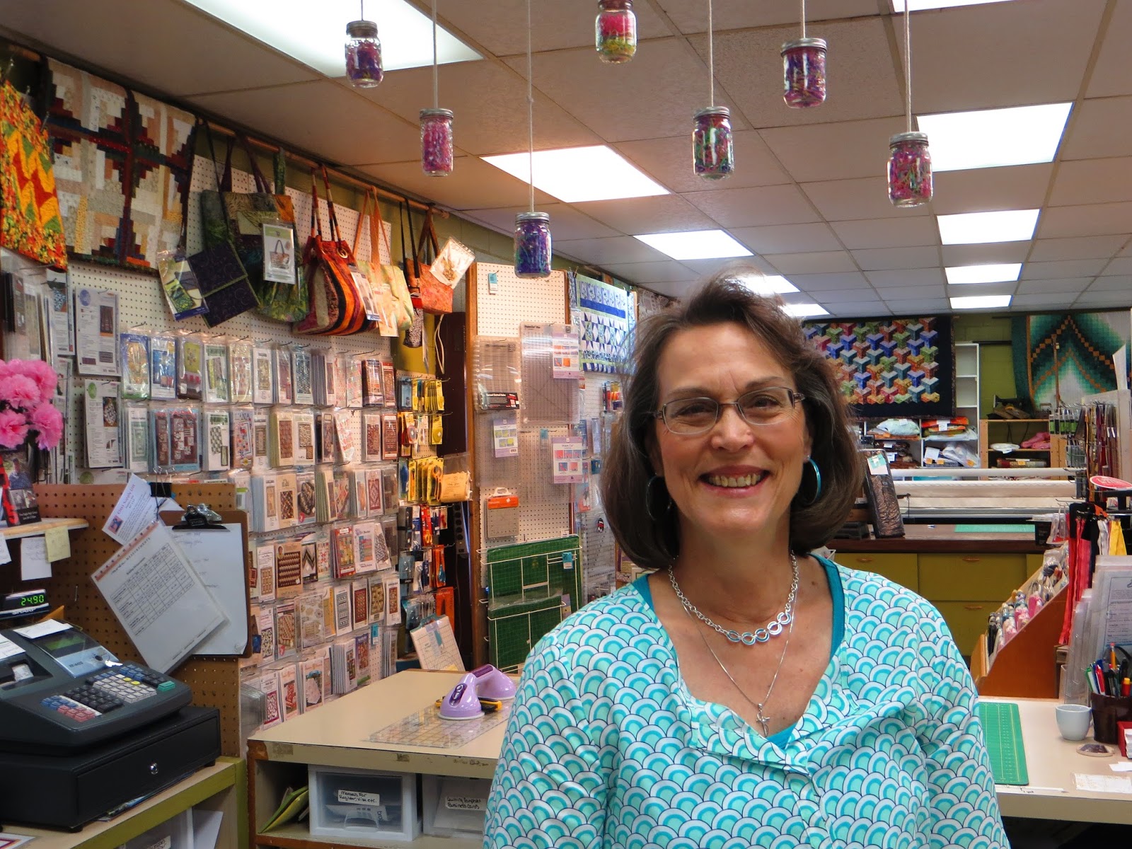
Returning to Halfway, I parked for a look around this quiet little burg. Again, on a rafter's recommendation I went searching for the quilt shop. After not being able to see Cornucopia, I was a little doubtful about what this shop would hold. To my delight the
Quilts Plus store was a lavishly stocked fabric store, creatively merchandised with kits and displays of project possibilities as well as a long arm quilting machine. The store manager, Cindy Thayer, gave me a tour of the business, pointing out a back room of antique collectibles as well as a drive/walkup coffee bar. She went on to give me the history of the store's growth, its popularity among distant quilters who come for classes and to stock up, and her personal involvement in Halfway's municipal business. An east coaster, Cindy was pulled to the relaxing charm of Halfway through family connections, a now familiar storyline in these small towns. The store is in the process of applying for a grant through a local bank, so contact them for support details.
 |
| Halfway yard decor |
Around the corner was Nella's Bakery, a tiny shop run by Nella, of course. She was a professional baker with a large company when family circumstances pulled her to Halfway where she eventually bought the bakery and cafe. She now bakes specialty orders for the locals, including gluten free breads, and prepares loads of food when the Cycle Oregon riders and biker troops come through town on their rides. In mutual support of the town's businesses she referred me to Halfway Whimsical, a local artists' cooperative display of paintings, jewelry and other artwork managed by Phil Wreden. He is a photographer in his own right in a family of artists. Living and working in this sweet valley is a photographer's dream. You can view and order his photographs
here. Restaurants, shops and a funeral parlor fill in more spots on the main street. The most engaging quality of Halfway is the habit of
everyone waving at you or saying a cheery hello. Drivers in particular all wave in greeting as you drive past them on the roadway, perpetuating a sense of familiarity and hospitality. This is definitely a town to visit.

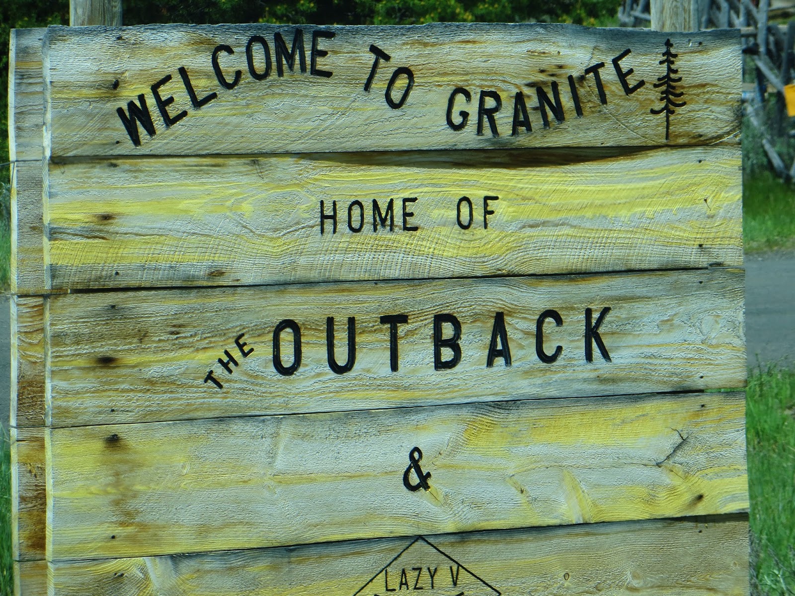
My final route on this N.E. Oregon tour was to be a Forest Service road heading northwest out of Baker City. Checking in at the Forest Service office in Baker City I was assured that the road was open so off I headed into the Blue Mountains, taking Highway 7 towards Sumpter and Ukiah where FS roads 24/52/53 would lead to Heppner and eventually to the interstate junction at Arlington. No storms assailed me on this drive through the mountains and the adventure of yet another new route kept my curiosity alert. Granite was recommended as a stop along the way where mining is still active in places. Arriving at a four-way intersection I turned up the hill to inspect what looked like a ghost town. Sparsely placed buildings dotted the hillside, all of which appeared to be unoccupied. Some where jauntily decorated with mining implements such as shovels and pick axes. Catching a buzzing sound I followed it to discover a woman weed wacking her front lawn, oblivious to my visitation in her town. Questions exploded in my mind about why, who, how but her intense focus excluded any notice of me. There was no spot to visit as even the local store appeared shut up so I moseyed back down the hill and into the trees where I was the only vehicle in a vast expanse of the Wallowa-Whitman National Forest.
 |
| Time to go home |
At first the scenery was cool and calm in its endless green span, hilltops sporting fantastic vistas of yet more forest. Passing the turnoff to Anthony Lakes, a popular ski resort nearby, I saw snowmobile paths and meadows but only occasional evidence of homes. One mine was still in operation with "keep out" signs posted but not much else was there. By Heppner I was bored with the monotonous scene and felt that my time on the road was winding down. The nuances of familiar territory began to touch my view so I decided to make tracks for Pendleton to catch the interstate and head for home. It was a long day on the road but clear weather and cruise control made the trip easy and smooth. I reflected on my 1300 mile journey and realized I had found a new best friend in N.E. Oregon territory. I would love to return soon and delve more into the nooks and crannies of this beautiful and historic section of my state. There's a lot more out there but you have to experience it to believe it!
"For my part I travel not to go anywhere but to go. I travel for travel's sake. The great affair is to move, to feel the needs and hitches of our life more nearly, to come down off the feather-bed of civilization and find the globe granite underfoot and strewn with cutting flints."
Robert Lewis Stevenson as quoted in Full Tilt by Dervla Murphy.
 |
| Early windmill for power |
 |
| Condon main street. Note the businesses. |
 |
| Condon Hotel lobby |
 |
| abandoned house |
 |
| White pine of a goodly size |
 |
| Sage and scenery out of Wasco |
 |
| Rabbitbush |
 |
| sunflower |
 |
| Purple prairie clover |
 |
| Painted Hills |
 |
| Painted Hills |
 |
| Shoe tree |
 |
| old soles |
 |
| Fossil farmhouse boarded up |
 |
| Old tree stump with new growth |
 |
| Cowboy memories |
 |
| Geiser Grand Hotel chandelier |
 |
| Baker City residence |
 |
| Pioneers' view to Baker City valley |
 |
| Bison photo op |
 |
| discarded b/c too much weight for the wagon |
 |
| Huge and grand state park |
 |
| Private lodge on the lake |
 |
| Looking for a buyer for the lodge |
 |
| Time has come and gone for this place |
 |
| Chief Joseph the elder's monument |
 |
| Wallowa Lake and park |
 |
| the bedroom |
 |
| the kitchen |
 |
| boats on the lake |
 |
| snow-covered tram pathway |
 |
| cloudy arrival at the 8100' summit |
 |
| why the top is not visible from lake |
 |
| Wallowa Lake |
 |
| the office and dining room |
 |
| Deerhead orchid |
 |
| unnamed wildflower |
 |
| Delilah the Great Dane pup |
 |
| Lava bluffs at Catherine Creek |
 |
| fence post detail |
 |
| Can't dig a hole? Prop it up style. |
 |
| Natatorium display area Baker City |
 |
| Museum mineral display |
 |
| Baker Heritage Museum |
 |
| Baker City house |
 |
| downtown Baker City |
 |
| Original Oregon Trail ruts |
 |
| circle the wagons! |
 |
| Modern day covered wagon |
 |
| Snake River above the dam |
 |
| Dawn in the canyon |
 |
| vertical walls above road |
 |
| Class II rapids |
 |
| abandoned farm implements |
 |
| salads in the canyon for lunch |
|
| Hell's Canyon |
 |
| poison ivy |
 |
| Lorquin's admiral butterfly |
 |
| house in the canyon |
 |
| wallpaper |
 |
| kitchen |
 |
| pictographs in canyon |
 |
| caretaker at one site |
 |
| packin' it up |
 |
| open range residents |
 |
| Halfway territory |
 |
| Quilt Plus interior display |
 |
| Cindy Thayer at Quilt Plus |
 |
| Halfway business |
 |
| Halfway church |
 |
| Phil Wreden of Halfway Whimsical |
 |
| Powder River greenery |
 |
| bird crossing the road |
 |
| no goats to watch for |
 |
| Granite mileage post |
 |
| empty structure at Granite |
 |
| abandoned mine shaft on FS road |


No comments:
Post a Comment